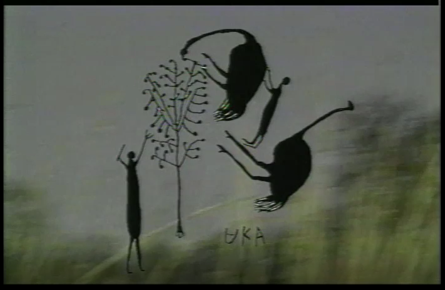
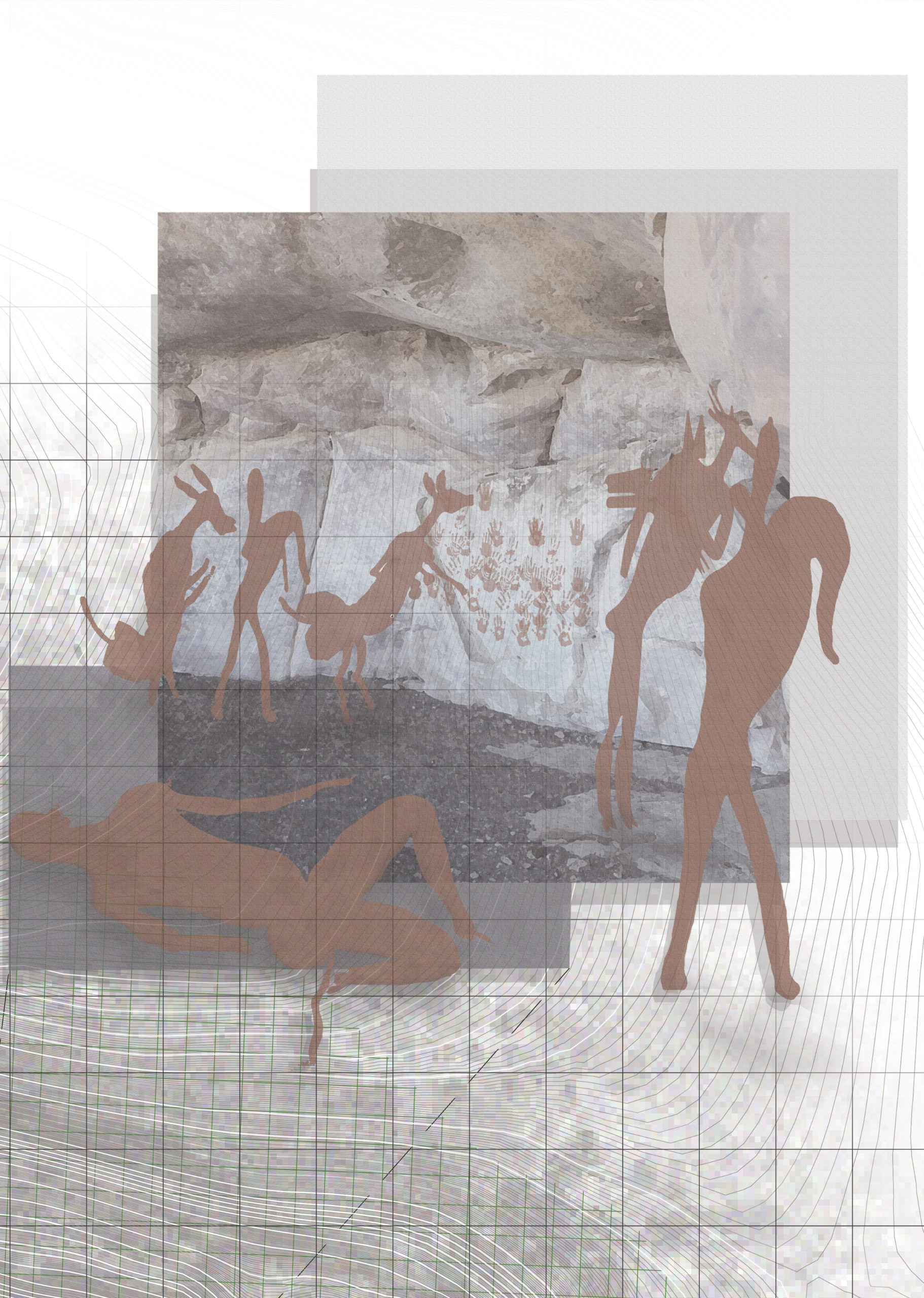
 Ritual processes take many forms for all civilizations and cultures. The San and Khoisan of South Africa’s Cederberg mountain catchment area a re understood as one first human civilization to make the transition from hunters and gatherers to our present agriculturally based culture. The Diepkloof rock shelter off the Verlorevlei Lake in Eland’s Bai, South Africa, is known as one of the sites where both the San and Khoisan civilizations held in the highest regard as both as once a shelter and then a sacred site for the performance of healing and birthing rituals. When arriving at the top of the rocky hill, it becomes clear as to why this site is held as an integral site for the history of human civilization. Imprinted on the walls of the rock caves, using the red pigment of the local iron-rich rocks of the landscape, are handprints as well as human, animal and hybrid paintings depicting the earlier use of this site as a shelter for both the male and female members of the group. In addition to paintings of ritual processes, which included depictions of an out-of-body experience where one would turn into a hybrid human-animal in order to gain wisdom and communicated with their surrounding land and spirits.
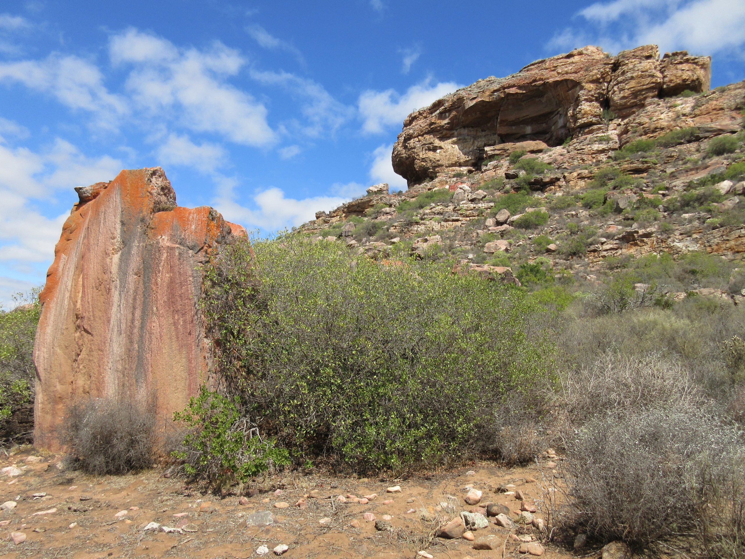
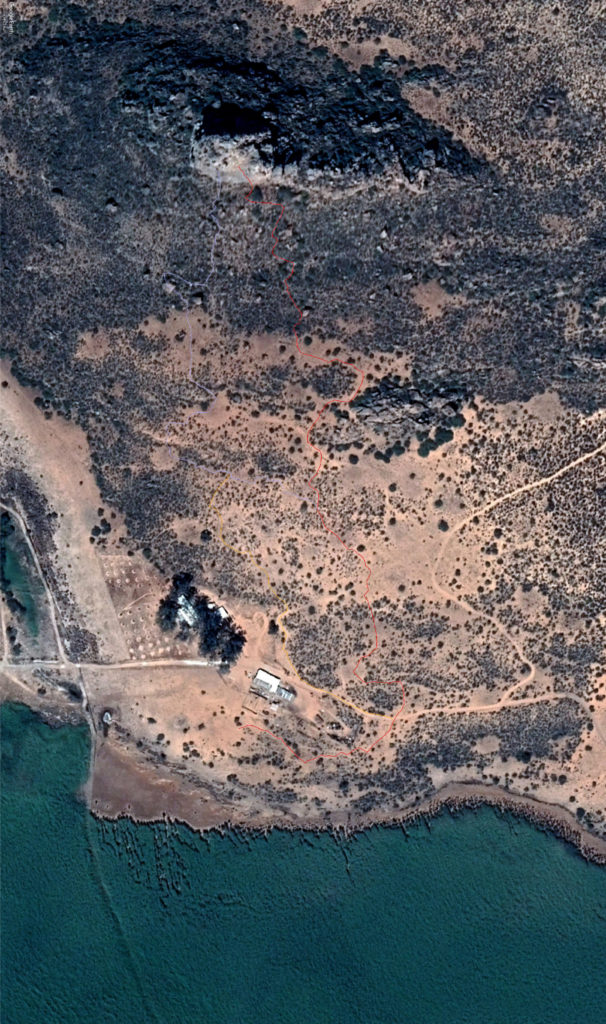
Currently, the site is in disrepair due to natural and human erosion caused by high pedestrian activity and unestablished hiking routes to the summit of the rock shelter. Declared as a provincial heritage site, the project seeks to develop and design a circuit based hiking route to the summit of Diepkloof Rock Shelter that promotes the education, and historical significance of this site will be restoring and maintaining the site from erosion, degradation and pollution. This educational hike will take the hiker through a series of pavilions in which they will participate in a self-guided ritual performance allowing the hiker to experience and connect to the culture and space both spiritually and physically by enjoying the rock art and of the views of the Cederberg landscape—promoting an appreciation for the site and its enchanting charm.
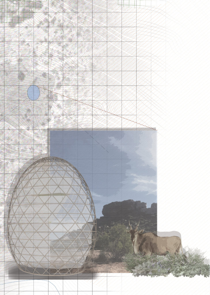
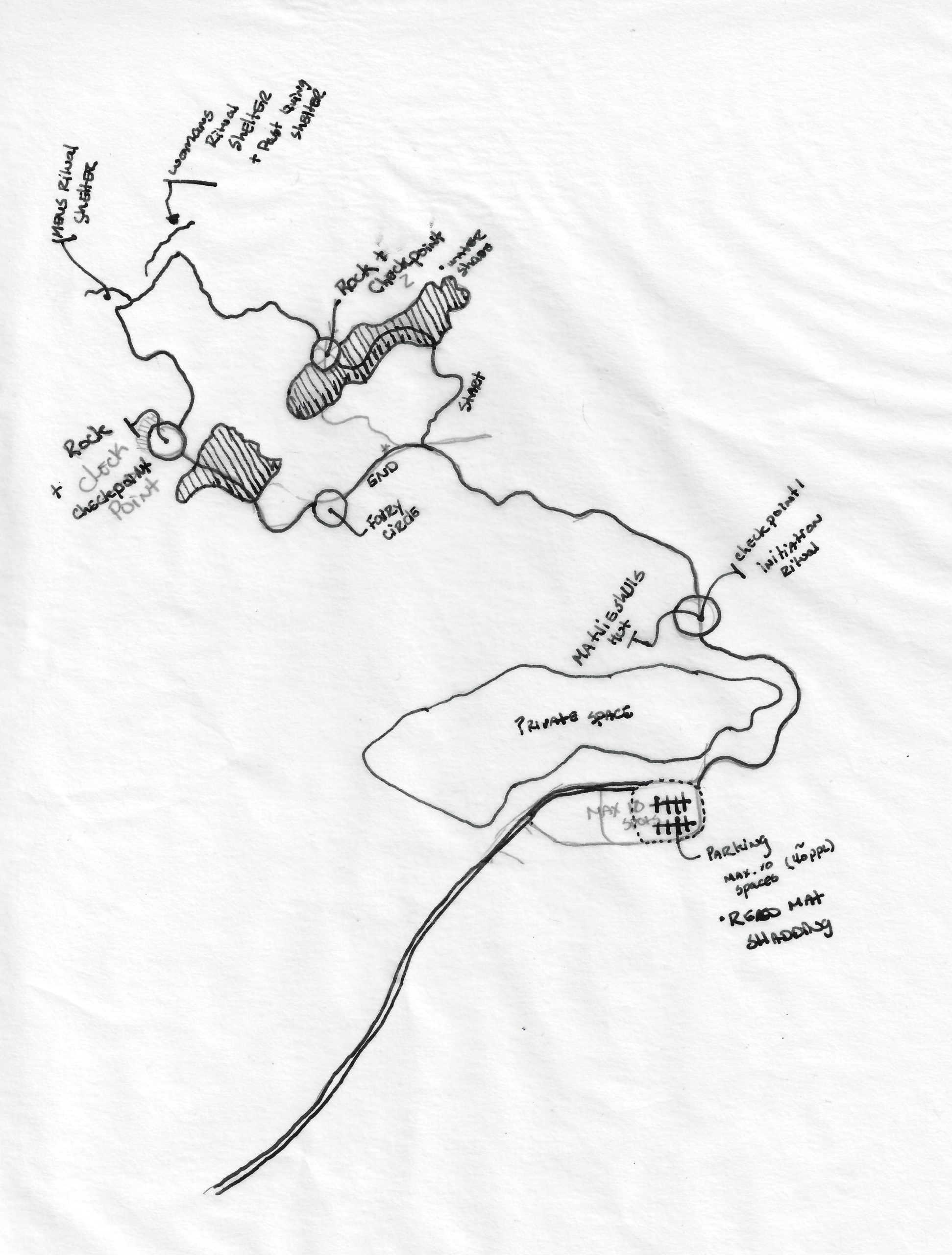
Ostrich Egg Water collection Pavilion
The first pavilion on the trail is a water collection structure that resembles the shape of an ostrich egg. Ostrich eggs were used by the San and Khoisan as water storage vessels that their culture would hide throughout the land in order to have water during long hunting excursions. Archaeologists found many of these ostrich eggs at the Diepkloof rock shelter. 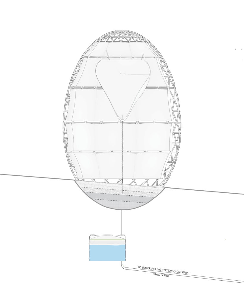 The Structure is designed to use both indigenous methods and materials to collect the oppressive morning humidity in the air and turn then into droplets. At the center of the Structure, the yoke, is a water collection sack to collect a higher amount of water. The San and Khoisan would typically store the ostrich eggs bellow ground to help keep the water at a drinkable temperature. The same was done with the water collection structure, where the water would run and from both water collection devices and pass through a natural rock filter to which it would be stored underground for later use.
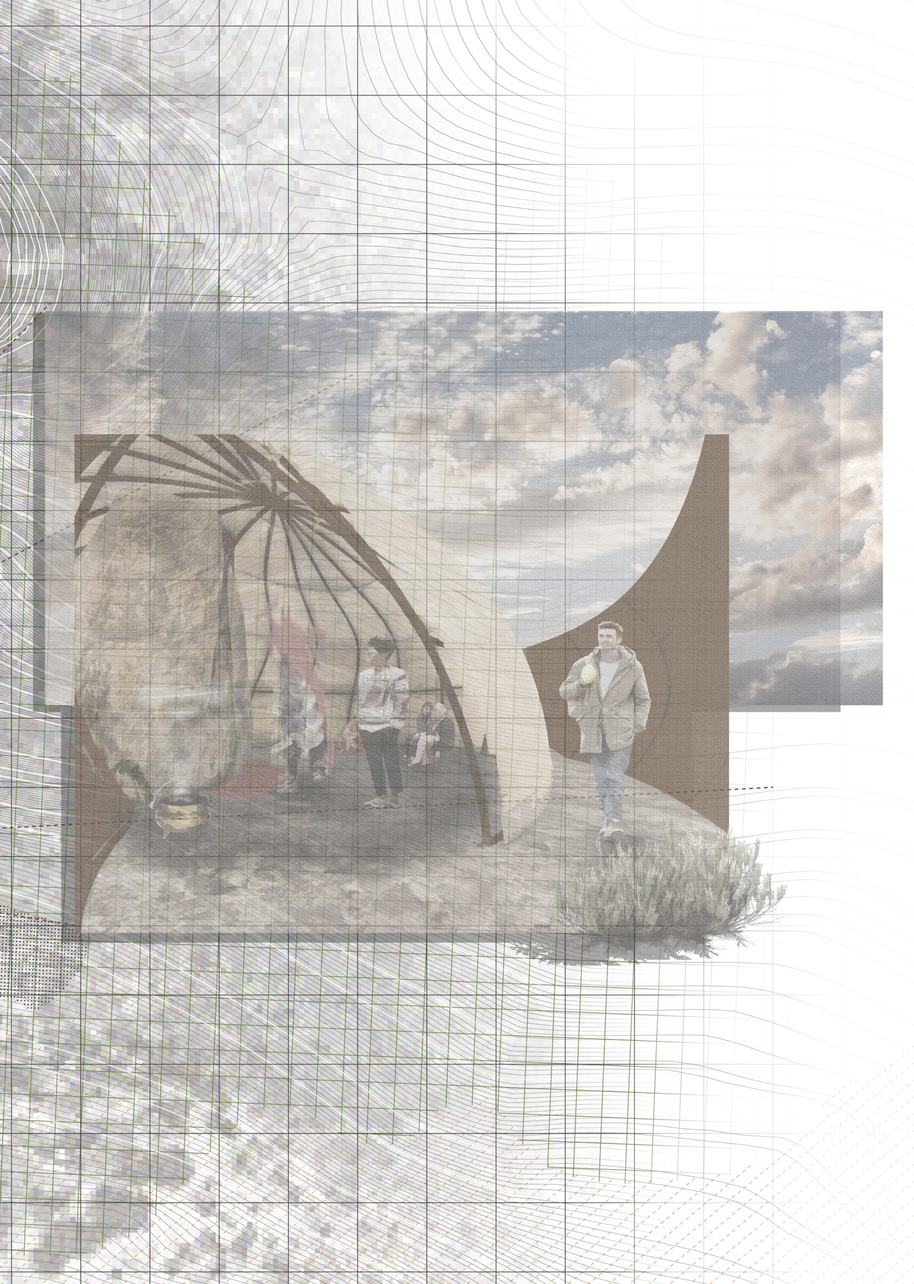
Ritual Matjieshuis Pavilion
Getting to the second pavilion, the hiker is greeted with a cup of rooibos tea served in an ostrich egg where the pavilion will wind the hiker into the pavilions enclosure, filled with a traditional incense understood to of been used for the shamans during ritual practices. The pavilion is therefore designed to take the hiker through a ritual uplifting preparing them for the proceeding hike up the hill to the rock shelters. Upon the descent, the hiker is welcomed to a decompression pavilion designed to allow the hiker a slow and peaceful transition back to their human self.
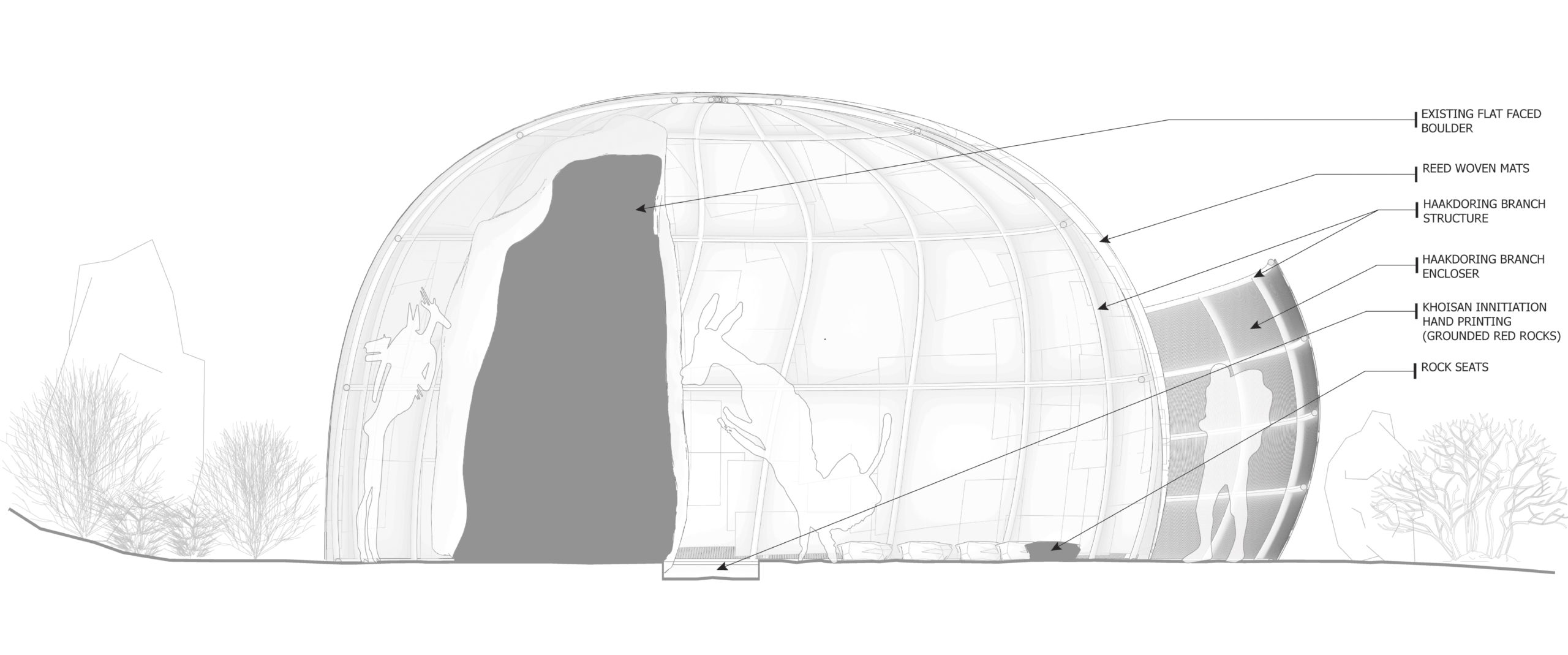
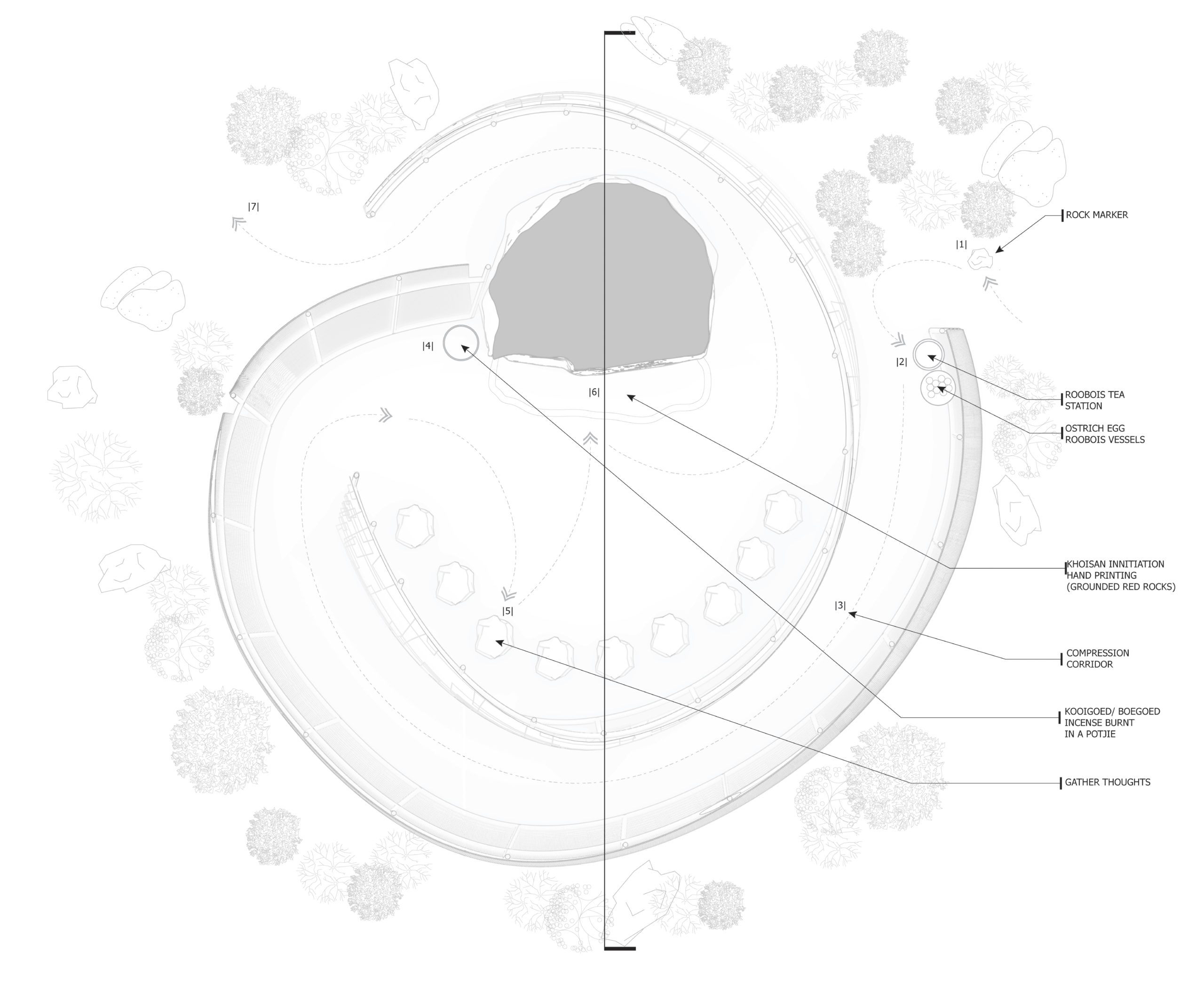
The pavilion is therefore designed to take the hiker through a ritual uplifting preparing them for the proceeding hike up the hill to the rock shelters. Upon the descent, the hiker is welcomed to a decompression pavilion designed to allow the hiker a slow and peaceful transition back to their human self.
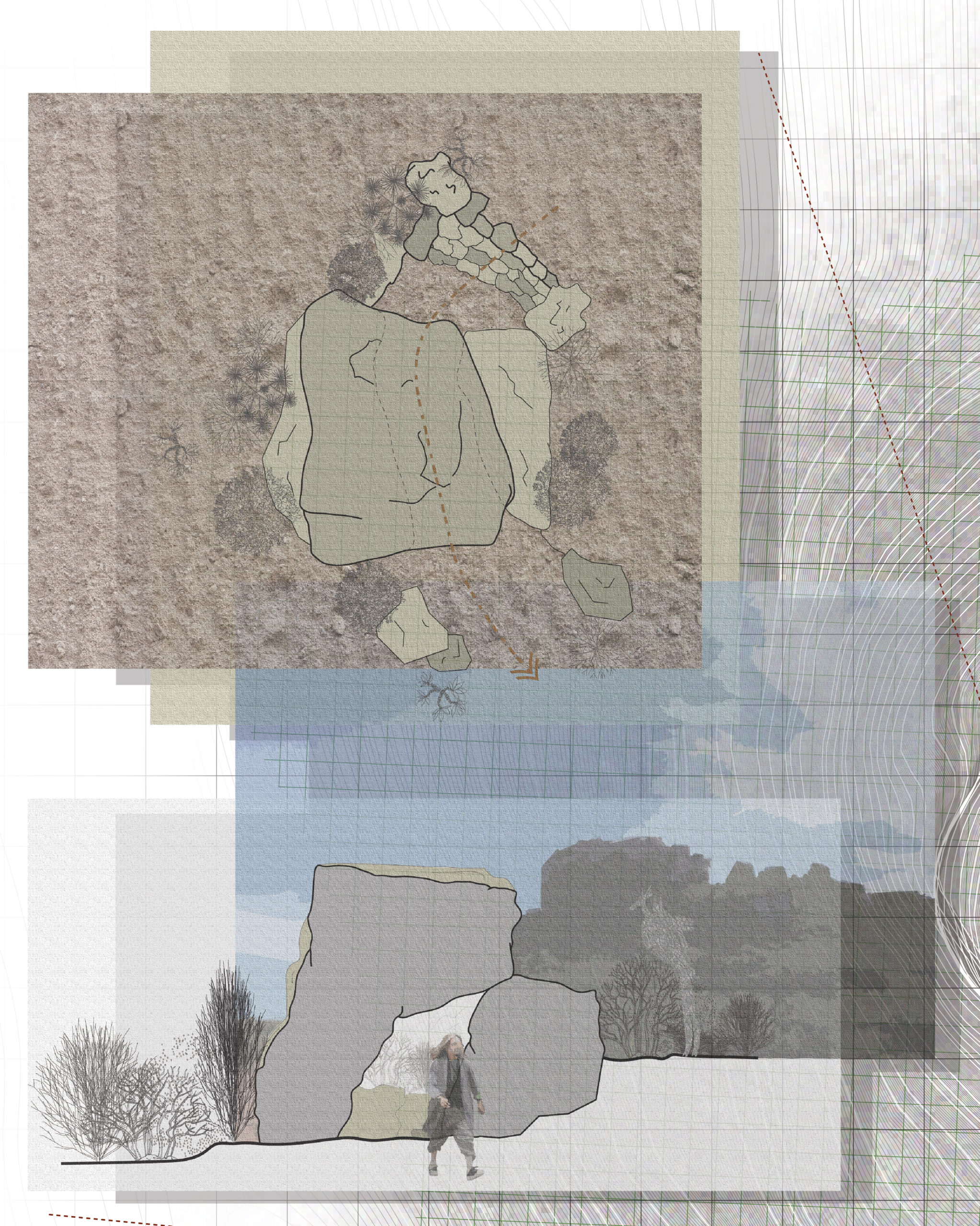
Exposing Diets Pavilion
The final pavilion is a semi-circular sunken pit, which reveals a termite colony. These termite colonies litter the site, where archaeologists have found that their existence is due to the San and Khoisan’s deposits of food waste. The pavilion helps to expose and educate the hikers on the diets of the San and Khoisan during this pivot transition in human civilization from Hunters and Gatherers to an Agriculturally based human civilization.
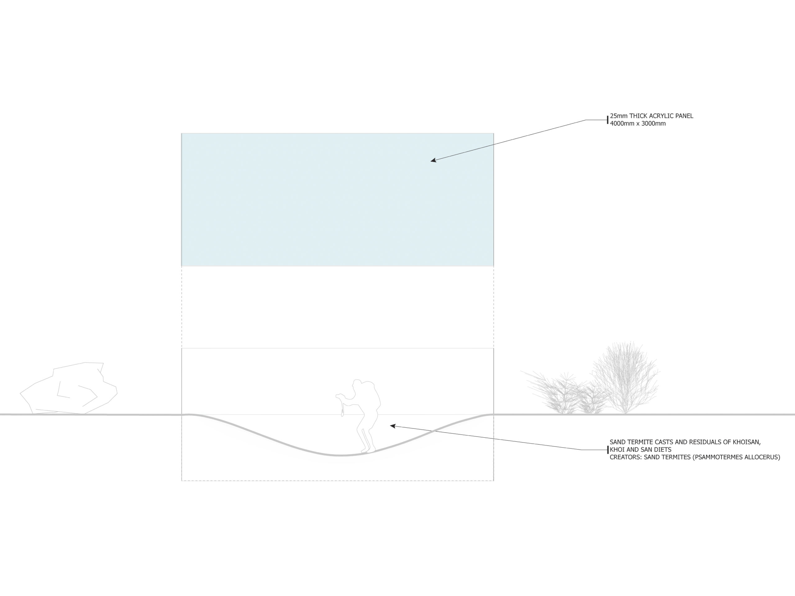
The pavilion helps to expose and educate the hikers on the diets of the San and Khoisan during this pivot transition in human civilization from Hunters and Gatherers to an Agriculturally based human civilization.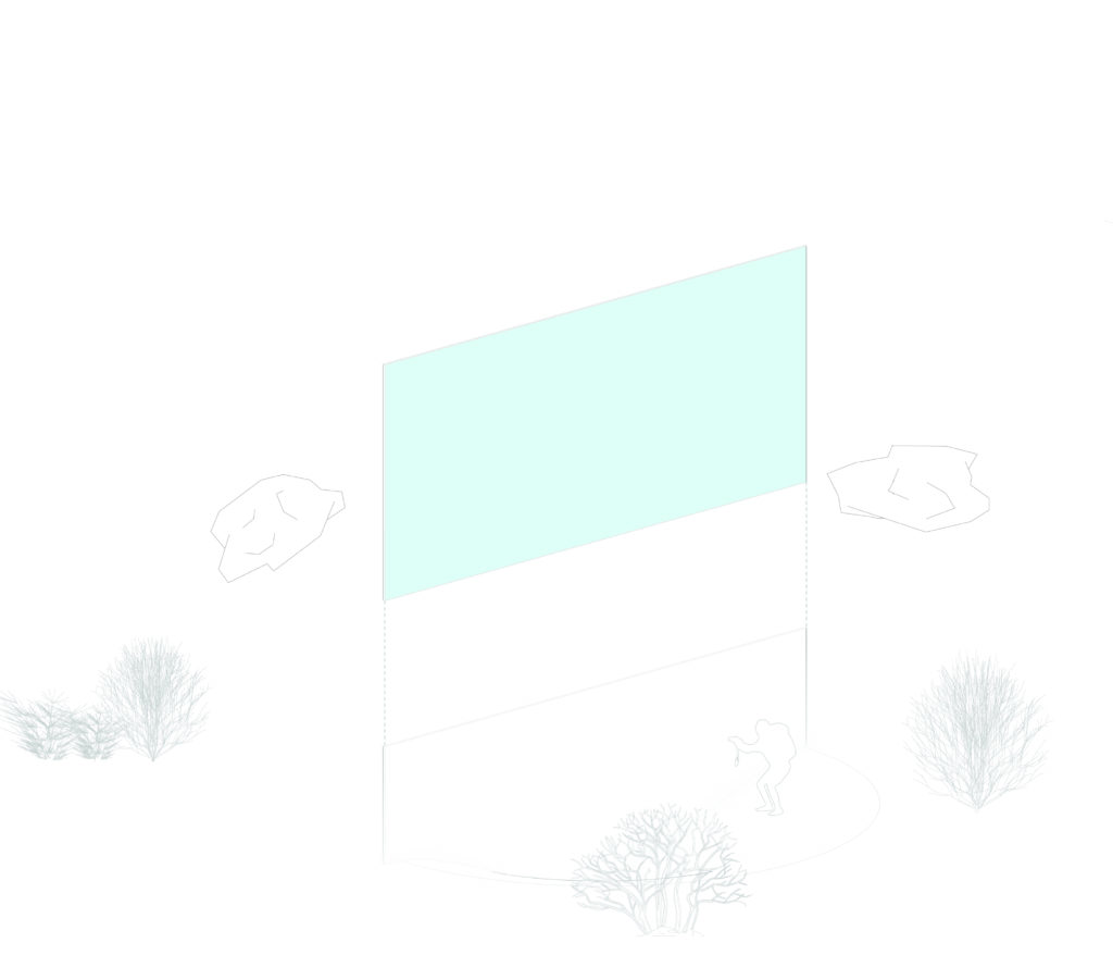
Full Map Pamphlet

Augmented Reality Tour Guide
Unity x Wiki Tube
The second part of the project was the integration of a phone application that would allow the hikers to experience the site with an Augmented Reality tour guide by scanning identifiable rocks along the trail which would give your phone information on various types of Environmental, Ecological, Historical, Archaeological, Geographical, Anthropological based on the location of the Rock Signifier.
This workflow was done using Unity and an augmented reality plug in called Wikitube which required the photogrametry of the Rock Signifier. Using the Mesh information from its photogrametric ‘twin’ the plug in allows for your phone to scan a particular rock signifier – similar to a QR code – and identify the proper information needed to be delivered to the hiker for there guided experience.
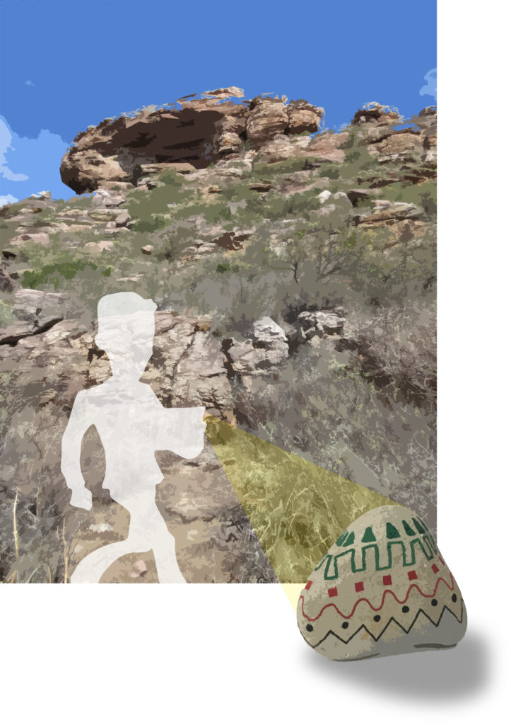
The image below is a frame taken from the example video used for the applications first iteration.
Sadly, due to hard drive complications the unity project and its documentation has become lost.